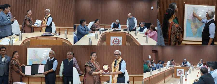
NIT Rourkela Signs MoU with Survey of India to Boost Geospatial Research and Innovation
The National Institute of Technology Rourkela and the Survey of India (Odisha & Chhattisgarh Geo-Spatial Directorate) signed a Memorandum of Understanding (MoU) on 11 February 2026 to promote collaboration in geospatial science, mapping technologies and advanced research in engineering and science. The partnership combines Survey of India’s expertise in national mapping and geodesy with NIT Rourkela’s strengths in geo-dynamics, remote sensing, earth sciences and climate studies. The agreement enables joint research projects, academic events and technical exchanges in alignment with the National Geospatial Policy–2022.
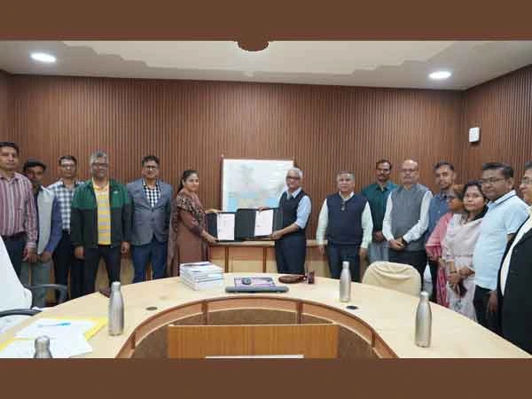
The MoU was signed by Prof. K. Umamaheshwar Rao, Director, NIT Rourkela, and Smt. Swarnima Bajpai, Director, Odisha & Chhattisgarh Geo-Spatial Directorate, Survey of India. The initiative was facilitated by Prof. Kishanjit Kumar Khatua (Department of Civil Engineering, NIT Rourkela) along with Shri Bharat Kumbhar and Shri Ashish Kaushal from Survey of India.
Signing the MoU, Prof. K. Umamaheshwar Rao noted that the collaboration is of national significance as it aligns with India’s growing emphasis on geospatial governance, digital mapping, climate resilience and infrastructure development. By combining national mapping authority expertise with academic research excellence, the partnership will contribute to precision geospatial infrastructure, climate and environmental monitoring, sustainable planning and disaster risk management. NIT Rourkela values the association with the Survey of India, the country’s oldest scientific department established in 1767, whose longstanding expertise in mapping and geodesy has played a foundational role in nation-building.
Detailing on the MoU, Smt. Swarnima Bajpai stated that this MoU marks a significant milestone towards integrating the rich legacy of the Survey of India with academic excellence, thereby bridging the gap between theoretical understanding and practical implementation. She said that collaborations with institutions like NIT Rourkela will strengthen geospatial education, research, and contribute significantly to national development.
Under the five-year agreement, NIT Rourkela will provide expert consultation on complex geodetic surveys and extend research-driven support for the professional advancement of Survey of India personnel. The Institute will facilitate specialised training, higher education opportunities and access to research facilities and academic resources. The collaboration will utilise advanced national infrastructure such as CORS (Continuously Operating Reference Stations) for scientific and applied studies. Intellectual Property generated independently will remain with the originating institution, while jointly developed outcomes will be co-owned. The MoU will also facilitate knowledge sharing, curriculum enrichment, technical skill development, workshops, conferences etc contributing to long-term institutional capacity building.
The signing ceremony was attended by senior officials and faculty members from both institutions. From NIT Rourkela, those present included Prof. Pradip Sarkar, Dean (Planning and Development); Prof. Rohan Dhiman, Registrar; Prof. Suresh Prasad Singh, Head, Department of Civil Engineering; Prof. Naresh Krishna Vissa, Head, Department of Earth and Atmospheric Sciences; Prof. Sanat Nalini Sahoo; Prof. Anurag Sharma; Prof. Jatin Anand and Prof. Minakshee Mahanada. Representing the Survey of India were Shri Jayanta Kumar Pradhan and Shri Manoj Kumar Nayak, Officer Surveyors. The Survey of India team presented Geodetic Asset Registers to the Director of NIT Rourkela during the event. The partnership is expected to enhance India’s geospatial research ecosystem and support national priorities in precision mapping and sustainable development.